Gallery (Click on titles!)
-
Marine Band Concert, Chichester Festival Theatre 6th December 2017
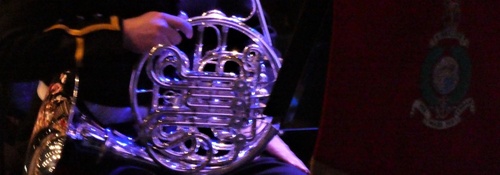
A very pleasant social evening in Chichester with a meal and then going to the Marine Band Concert in the Festival Hall. Very entertaining, with help from the Chichester Cathedral choir. Many thanks to Marian for organising the evening.
Henley Day/Morning Walk 6th December 2017
This was a day walk that we shortened to a morning walk. Weather was cold but not freezing and we had a few inclines (hills!) to warm up with early on the walk. Tree clearance and no leaves on the trees meant we had some excellent views towards Blackdown and Marley early on and once we had reached the ridge going towards Older Hill we had some excellent views over Titty Hill as far as the pylon on Butser Hill. Lunch was in the wonderful Duke of Cumberland Arms in Henley village where some of us took advantage of the half price/half size portions that are available. Thanks to Jane for additional photos. The walk was about 4.3/4 miles with about 740 feet gained.
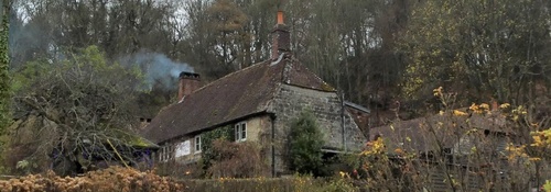
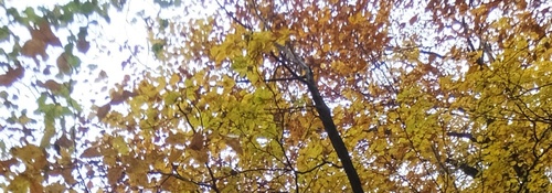
Milland Morning Walk 29th November 2017
Peter and Trevor had planned a walk from the Milland Village Hall and ending at The Rising Sun. The weather was dry, sometimes sunny and fairly cold. We had some interesting sights, some natural and some artificial - the lane back from Titty Hill was fairly muddy but passable. Very pleasant walk of about 4.1/2 miles with about 290 feet height gained.
Hawkley Day Walk 22nd November 2017
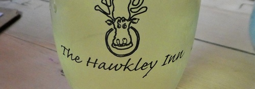
This walk, led by Denis, started at the Newman Collard car park and took us up across the A3 for a pleasant walk through the countryside to the wonderful Hawkley Inn for lunch. We returned very well refreshed via a different route and some thought they saw the same pair of deer as we had spotted in the morning. Also seen were some early primroses, so perhaps spring is just around the corner. We walked 7.1/2 miles with 390 feet gained.
East Dean Morning Walk 15th November 2017
Jennifer led this short walk up above the village of East Dean over Court Hill, an area much favoured by Celtish farmers. After skirting Wood Lea, we stopped for a break on North Down, with views to Goodwood, but a little hazy on the day. A perilous descent took us onto North Lane to reach the path up to Wood Lea and then return to East Dean. Lunch was at The Fox Goes Free in Chalton where we had an excellent lunch. Thanks to Jane for extra photos.
Recent galleries
- Pagham walk on 15th July 2026
- Earnley on 8th July 2026
- Kingley Vale on 1st July 2026
- Elsted walk on 17th June 2026
- Heyshott Walk on 10th June 2026
History
2026
2025
- December (3)
- November (4)
- October (5)
- September (4)
- August (4)
- July (5)
- June (4)
- May (5)
- April (4)
- March (5)
- February (3)
- January (4)
2024
- December (3)
- November (5)
- October (4)
- September (4)
- August (4)
- July (4)
- June (5)
- May (5)
- April (5)
- March (5)
- February (5)
- January (4)
2023
- December (3)
- November (6)
- October (5)
- September (5)
- August (3)
- July (4)
- June (6)
- May (5)
- April (4)
- March (5)
- February (4)
- January (4)
2022
- December (4)
- November (5)
- October (5)
- September (3)
- August (4)
- July (6)
- June (11)
- May (4)
- April (5)
- March (4)
- February (5)
- January (4)
2021
2020
- December (4)
- November (1)
- October (5)
- September (4)
- August (3)
- July (3)
- March (2)
- February (5)
- January (3)
2019
- December (2)
- November (5)
- October (4)
- September (3)
- August (4)
- July (4)
- June (11)
- May (5)
- April (4)
- March (3)
- February (5)
- January (5)
2018
- December (2)
- November (4)
- October (4)
- September (5)
- August (4)
- July (3)
- June (5)
- May (8)
- April (4)
- March (4)
- February (5)
- January (3)
2017
- December (3)
- November (5)
- October (3)
- September (4)
- August (4)
- July (4)
- June (11)
- May (4)
- April (4)
- March (3)
- February (4)
- January (5)
2016
- December (3)
- November (4)
- October (5)
- September (4)
- August (3)
- July (6)
- June (11)
- May (4)
- April (5)
- March (3)
- February (10)
- January (2)
2015
2014
- June (2)
1997
- February (1)